Checked
Oshawa walking and cycling trails: routes, distances and access
Oshawa, Ontario, Canada
Oshawa lists six main recreational trail routes. Use the route table to choose a distance, then check closures and the named access point before setting out.
Key information
Oshawa lists six main recreational trail routes. Use the route table to choose a distance, then check closures and the named access point before setting out.
On this page
Six routes in the city trail guide
| Route | Listed length | Surface or setting | Named access |
|---|---|---|---|
| Harmony Creek Trail | 4 km | Paved multi-use trail with steep slopes and creek edges | Donevan Recreation Complex, Eastbourne Park and Farewell Park |
| Joseph Kolodzie Oshawa Creek Bike Path | 7 km | Paved creek-valley route | Bloor and Simcoe, Brick by Brick Park, Children’s Arena, Erie Park, Botanical Gardens, Lakeview, Rotary, Southmead and Storie parks |
| McLaughlin Bay Wildlife Reserve | Nearly 7 km | Natural reserve with trails and viewing platforms | Ontario Power Generation head office |
| Michael Starr Trail | 5 km | Relatively flat paved former railway route with road crossings | Cowan Park |
| Second Marsh Wildlife Reserve | 2.5 km | Wetland trails | Farewell Street and Colonel Sam Drive |
| Waterfront Trail in Oshawa | 11 km | Lake Ontario shore route between Whitby and Clarington | Lakeview, Ed Broadbent Waterfront, Lakefront West, Renaissance and Stone Street parks; Pumphouse Marsh and Second Marsh |
Sources: Parks and Trails
Compare listed route lengths
- Harmony Creek Trail4 km
- Joseph Kolodzie Oshawa Creek Bike Path7 km
- Michael Starr Trail5 km
- Second Marsh Wildlife Reserve2.5 km
- Waterfront Trail in Oshawa11 km
Sources: Parks and Trails
Your visit at a glance
- Compare six routes
Use listed lengths, surfaces and access points.
- Check closures
Read the Gibb Street bridge reroute and seasonal limits.
- Follow trail rules
Reserve dog rules and creek-edge conditions differ by route.
Sources: Parks and Trails
Closures and limits
The city reports a closure beneath the Gibb Street bridge on the Joseph Kolodzie path. A temporary reroute is in place. Follow the signed route rather than entering the closed section.
The city describes Harmony Creek as accessible and paved, but also warns of steep slopes and edges near the creek. A paved surface does not mean a flat route. Seasonal flooding and freezing can change trail conditions.
Sources: Parks and Trails
Reserve rules and responsible use
McLaughlin Bay Wildlife Reserve covers about 87 acres. Camping, open fires and dogs are not allowed, apart from certified guide dogs on the Dogwood Trail. Second Marsh is a 140-hectare wetland with important wildlife habitat.
Stay on marked trails, keep right, leave space for others and take litter home when bins are unavailable. Motor vehicles and hunting are prohibited. Where dogs are allowed, the city trail code requires a leash no longer than two metres.
Sources: Parks and Trails
Named access points with verified park addresses
Cowan Park
125 Olive Ave, Oshawa, Ontario, Canada
The city names Cowan Park as an access point for the Michael Starr Trail. The route follows a former CN spur line and reaches downtown.
Sources: Parks and Trails · Oshawa official park land inventory
Rotary Park
254 Centre St S, Oshawa, Ontario, Canada
Rotary Park is one of the named access points for the Joseph Kolodzie Oshawa Creek Bike Path.
Sources: Parks and Trails · Oshawa official park land inventory
Lakeview Park
55 Lakeview Park Ave, Oshawa, Ontario, Canada
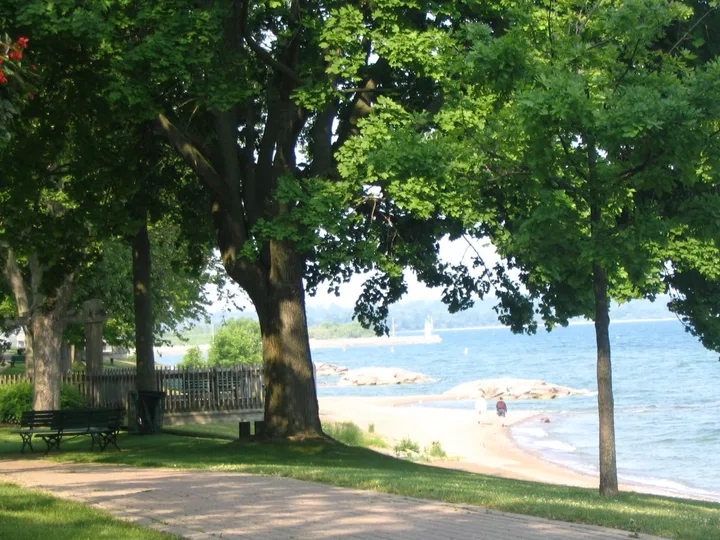
Lakeview Park connects with the creek bike path and the Waterfront Trail. It provides a connection between the lakeshore and the creek valley.
Sources: Parks and Trails · Oshawa official park land inventory
Sources: Parks and Trails
Questions and answers
How many main trails does the city describe?
Six: Harmony Creek, Joseph Kolodzie, McLaughlin Bay, Michael Starr, Second Marsh and the Oshawa Waterfront Trail. This is the city guide scope, not every path or sidewalk.
Source: Parks and Trails
How long is the Waterfront Trail in Oshawa?
The Oshawa section is 11 km, from Whitby in the west to Clarington in the east.
Source: Parks and Trails
Which trail follows an old railway?
The 5 km Michael Starr Trail follows a former CN industrial spur. It is paved and relatively flat, with several road crossings.
Source: Parks and Trails
Where is the Gibb Street closure?
It is beneath the Gibb Street bridge on the Joseph Kolodzie Oshawa Creek Bike Path. Follow the temporary signed reroute.
Source: Parks and Trails
Is Harmony Creek completely flat?
No. The paved 4 km route includes steep slopes and edges near the creek.
Source: Parks and Trails
Can I take a dog to McLaughlin Bay?
Dogs are prohibited, except certified guide dogs on the Dogwood Trail.
Source: Parks and Trails
Where can I access the Michael Starr Trail?
The city names Cowan Park. On-road connections link it with the creek bike path and Harmony Creek Trail.
Source: Parks and Trails
What leash length applies on city trails?
The city trail code says no longer than two metres, wherever pets are allowed.
Source: Parks and Trails
Are trail conditions the same all year?
No. Flooding and freezing may change conditions. Closed sections and reserve rules still apply.
Source: Parks and Trails
Do trail signs help with navigation?
Some signs have QR codes linking to directions, park details and nearby points of interest.
Source: Parks and Trails